Home › Forums › Pilot Alerts & TFRs › required viewing for all css members!
Tagged: airspace
- This topic has 2 replies, 3 voices, and was last updated 3 days, 8 hours ago by
 David Webb.
-
AuthorPosts
-
October 22, 2026 at 8:52 AM #24834October 22, 2026 at 6:42 PM #24836
 Jonathan Dietch Premium Member
Thanks guys!
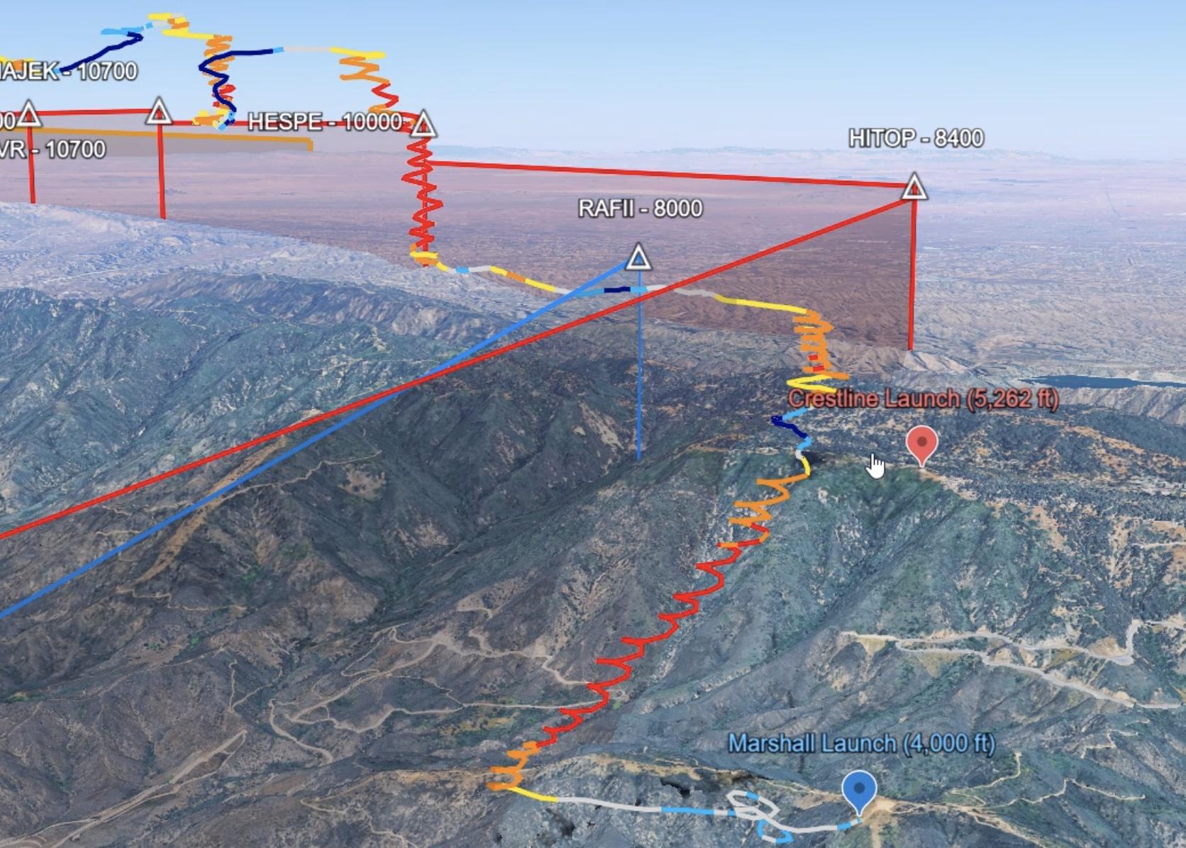
Please keep in mind that those lines in space are merely approximations to reality. There is no place from Cajon Pass to Heaps Peak that I haven’t had close encounters with inbound commercial jets and other assorted fixed and rotary wing aircraft heading to Ontario, San Benardino, Redlands, March ARB, etc. Altitudes were treetop to 10K. My point is we need 360° awareness at a reasonable interval. (Nate may be working on an omniview periscope to compliment his belayer’s prisms). And then there’s fire season which can really add some head-turning. A higher level subscription to flightaware24 can yield 3-years worth of KML files into any local airport which could give a better idea of reality.And never forget we get hind tits below Mother Sky!
October 23, 2026 at 2:05 PM #24837 David Webb General Member
Ditto on the above.
On Monday, I had never seen so many aircraft in the area. I was in a nice climb at 7k between McK and Harrison, and ended up spiraling down. I looked to the back ridge and noticed a fairly spooky trajectory on an inbound and opted for as much margin as possible. Its heading was almost due south, coming from directly over Lake Arrowhead which looked well outside those 2 approach paths. Noticed the same with several other aircraft during the flight.
Seems like good advice to just keep your head on a swivel if you’re over 6k – no matter where you are along the range.
-
AuthorPosts

- You must be logged in to reply to this topic.