Home › Forums › Pilot Alerts & TFRs › Friendly reminder: TFR still in effect for Line Fire
Tagged: TFR bigbear fire
- This topic has 9 replies, 7 voices, and was last updated 1 year, 3 months ago by
 Luke Berger.
-
AuthorPosts
-
October 5, 2024 at 6:02 PM #21062
 David Webb General Member
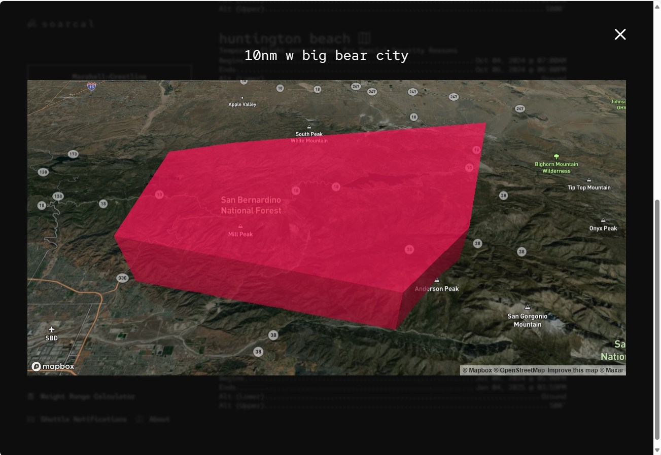
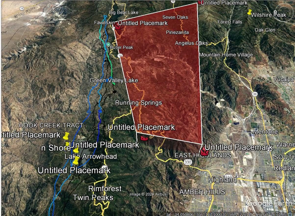
Regardless of the forest service closure, a friendly reminder about the TFR still in effect to the east. It extends from 330 (so all of Harrison is off limits) to east of Big Bear Lake. Here’s a 3D view of that (click on the map icon next to the title):
October 6, 2024 at 5:49 AM #21063 Tom Swanson General Member
 October 7, 2024 at 7:18 AM #21069
TFR size reduced yesterday.

and..The convergence was well marked. 16.7k base. Sailplanes were out in force Sat and Sun flying the line from Campo to Grapevine….and back! They have ADS-B onboard and can be followed on the flight trackers.
![20241006_145739[1]](https://crestlinesoaring.org/wp-content/uploads/hm_bbpui/21069/zuxu0i14gi46hxhj5jkgwpqb954a9dy6.jpg) October 7, 2024 at 2:56 PM #21077
October 7, 2024 at 2:56 PM #21077Never mind, Dan already asked the same question i did.
October 7, 2024 at 5:27 PM #21082AKA a LFR – “Lukes Flying Restriction”.
October 18, 2024 at 7:33 AM #21114 David Webb General Member
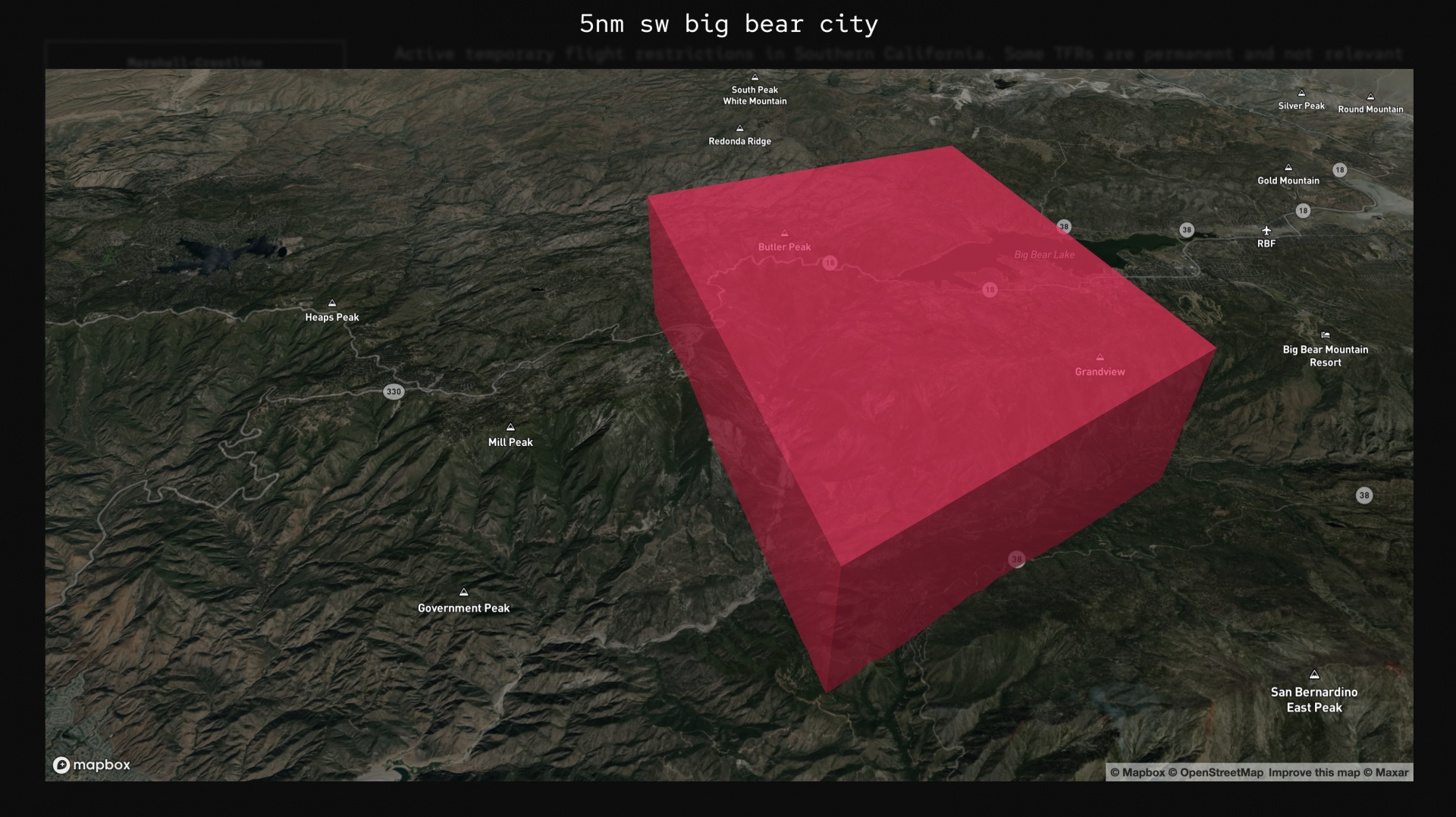
Looks like the fire closure area is still the same, but I see that the Big Bear TFR has been shrunk by quite a bit (its western edge is now east of the dam). That’s forward progress.
 October 21, 2024 at 8:15 PM #21160
TFR is eliminated.
But the SB Natl Forest closure is still in effect, and we must remain West of Hwy 18.
October 22, 2024 at 6:14 AM #21162Upon whose authority? CSS? TFR boundaries are plain as day. USFS has no control over the airspace.
Voluntary compliance is the most anyone can request. As far as mandating?
Nope.
October 22, 2024 at 10:43 AM #21164Mario Miralles
Premium MemberOk, I’m confused on this subject as I completely read this situation as Dan does. While I know there was a discussion between Luke and the FS weeks ago about voluntarily staying West of the 18, this seems very out of date as the Line Fire is out and this westward “clear” area only pushes us closer to the still burning Bridge Fire.
I would even argue that going East over and North of the Rim of the World is fine under the FS agreement.
So, after Jerome’s and Dan’s comments, could we have an updated official posting on the subject.October 23, 2024 at 1:42 PM #21173Mario,
The Bridge Fire is also basically out, 99% contained as of 21 OCT. The closure maps are a little more tricky because most of the Bridge Fire occurred in Los Angeles County and only partially in San Bernardino County. The original SB National Forest closure map went across the 15 and past Mt Baldy (the SB/LA County border). Right now I can’t find any current closure map related to the Bridge Fire.
In any case, the reason we are respecting the NFS closure order is due to the risk of pilots landing out within the current closure area by flying to the east, worst case having an incident that requires rescue. Its not an airspace issue, its preventing the possibility that first responder resources being directed at a rescue within the closure area, and that would put a very negative light on our activity. This would be the same for Mountain Bikers, Hikers, Climbers, UTV Drivers, anyone… and there is a pretty hefty personal fine involved too. We aren’t going to put the Club’s positive relationship with the NFS at risk (or CALFIRE, SBPD, Sheriff)
-
AuthorPosts
- You must be logged in to reply to this topic.