- This topic has 0 replies, 1 voice, and was last updated 3 years, 11 months ago by
 Jerome Daoust.
-
AuthorPosts
-
April 29, 2022 at 8:58 PM #15075
Maybe it went into one ear and out the other during you training, it was never mentioned, or maybe you know more, but it doesn’t hurt to repost here what I was sharing about this weekend’s forecast, relative to the local terrain influencing the wind flow…
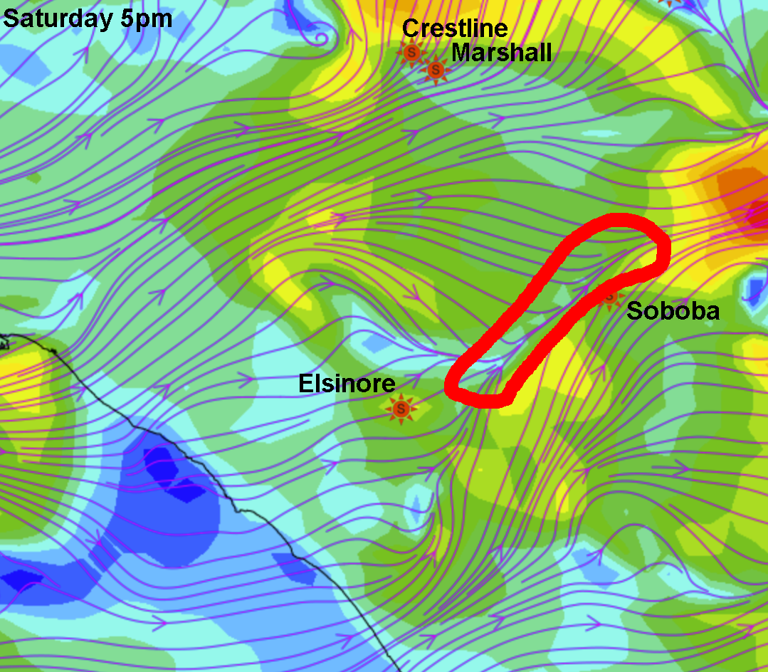
I was recently explaining how the “Elsinore convergence line” can have a significant influence on the wind direction at Soboba, making it less predictable in advance than Marshall. But could read disbelief in the recipient’s body language. It can be clearly visualized in the wind lines, for example using this forecasting tool:
- Select day and time.
- Select a parameter like “Sfc.Wind (10m)”.
- To change the opacity of the data layer: Click the “+” or “-” icons in lower right.
- Finding flying sites: Hover your mouse pointer over the markers, names appear.
Below is a snapshot, where I contoured in red, the convergence line for Saturday 2022/4/30 at 5pm. If the forecasted convergence line was to relocate slightly to the SE side of Soboba, there will be WNW wind (non-launchable) instead of an ideal SW at Soboba.
On Sunday, the line is forecasted to be further to the NW of Soboba, increasing the odds of a favorable wind direction. Forecasts can change.One can also notice how the San Gabriel mountains (to the right of where you read “5pm” on the image below) curls the wind lines more favorably for Marshall/Crestline, explaining why the wind is so often favorable there.

-
AuthorPosts
- You must be logged in to reply to this topic.