Home › Forums › Pilot Alerts & TFRs › Possible TFR this weekend 7-15 & 7-16 and longer?
- This topic has 11 replies, 4 voices, and was last updated 2 years, 10 months ago by
 David Webb.
-
AuthorPosts
-
July 14, 2023 at 8:19 PM #18546
There are 5 active fires between San Bernardino and San Jacinto city that may result in TFRs this weekend that could affect pilots flying East of Crestline and may shut down any Flying from Soboba or at least North of it. No TFRs posted as of now despite a lot of aerial firefighting traffic thru out the area today. I will try to link here for any TFRs that get posted for tomorrow, but please check on your own before flying this weekend. I believe the sailplane club at Hemet is expecting to be grounded tomorrow (and beyond?) See you in the air, Alan
July 14, 2023 at 9:10 PM #18548For those waiting for updates, they can use this to easily find a TFR over a map of our area… SkyVector.
July 14, 2023 at 10:18 PM #18549First TFR for 7-15-23…. There could be more to follow?
https://tfr.faa.gov/save_pages/detail_3_6869.html
July 15, 2023 at 12:07 AM #18550Using the coordinates (33º53’22″N, 117º04’15″W) provided for the center of that TFR (with a radius of 5 nautical miles) and the distance to Soboba, it puts the launches outside by a safety margin of 2 miles (1.8 nautical mile).
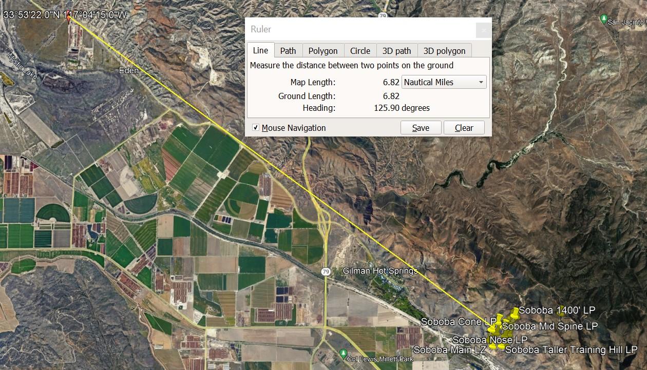
Still a good idea to be conscious of air traffic, and avoid heading West of launches by any significant amount.
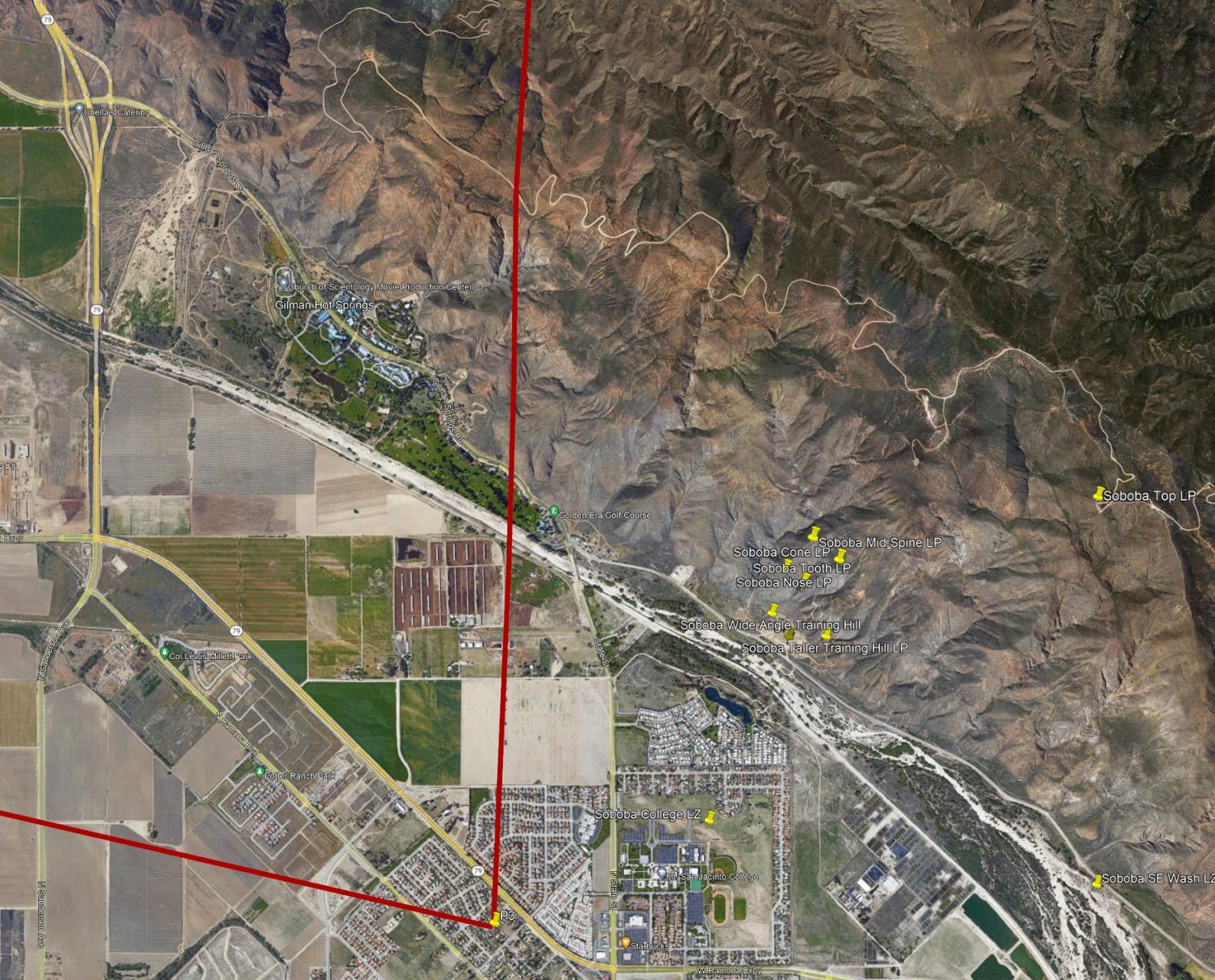
July 15, 2023 at 3:08 PM #18552July 15, 2023 at 10:16 PM #18556Getting closer, but Soboba flight park is still outside…
 July 17, 2023 at 12:09 AM #18566
 Jonathan Dietch Premium Member
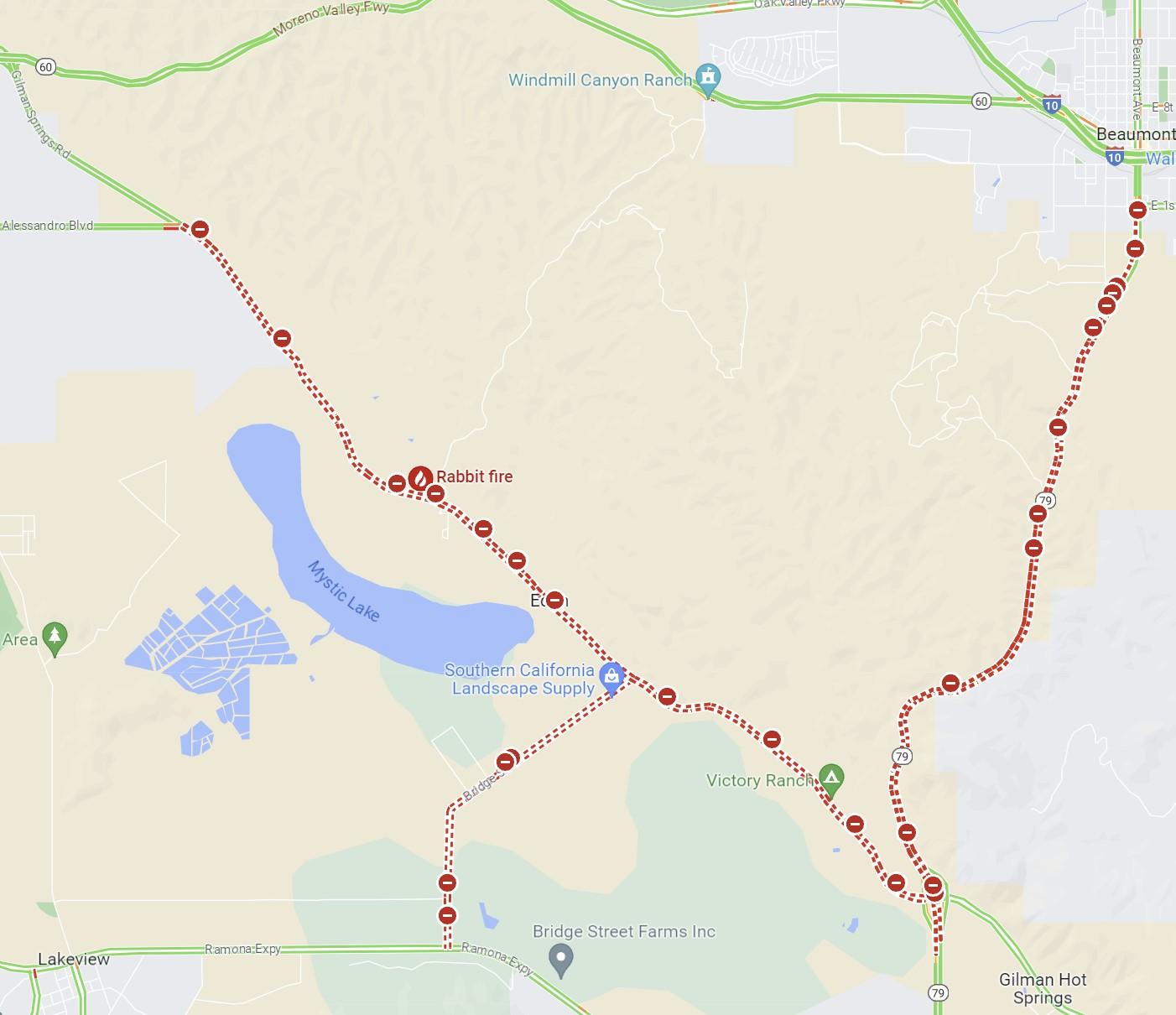
TFRs in KML are much easier for me to visualize and plan around.
http://soaringdata.info/tfrs/tfrs.php
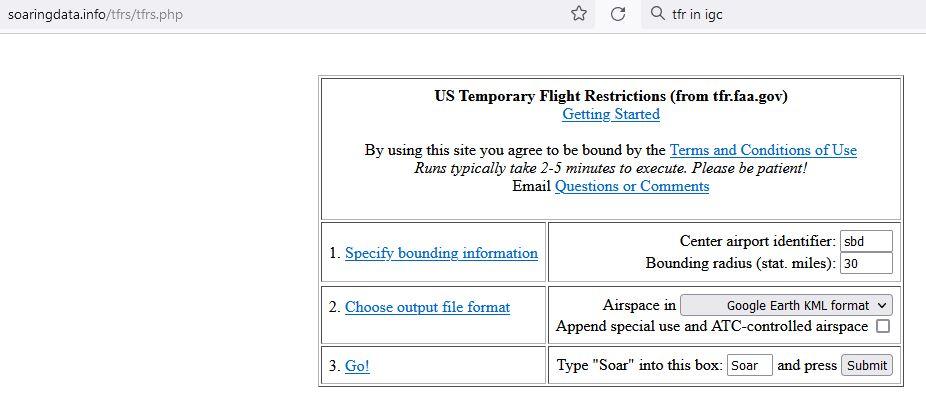
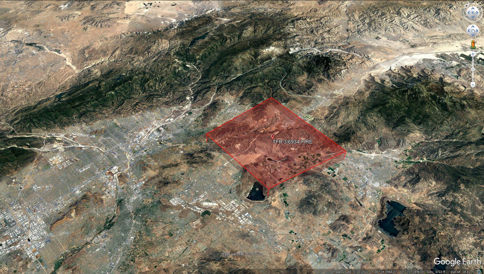
The current TFR looks like this…
 July 17, 2023 at 12:12 PM #18567
Nice tool Jonathan. The TFR is continuously evolving (and using new ID’s), now including the Soboba flight park…
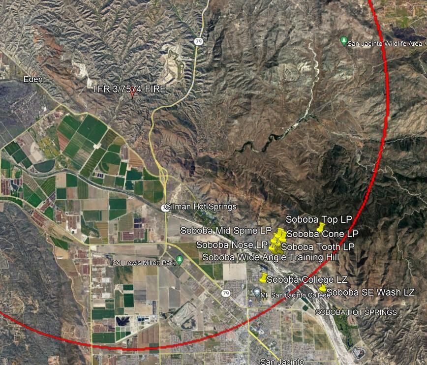
Some local roads are closed as well…
 July 17, 2023 at 12:21 PM #18568
 David Webb General Member
Since we’ll likely have more this season (and every fire season), I’m going to put a simple tool together that we can punch in a TFR ID, and it will spit out a 3D map with the exclusion area on it. More to follow…
July 17, 2023 at 1:01 PM #18569The TFR ID’s change often. For the Rabbit fire near Soboba, it seems to be up to the 3rd ID now. To make the confusion worse they don’t indicate quickly when an old one has been superseded if you just look up that ID. So it may be best to avoid entering an ID which can be obsolete, and instead rely on a search area. This may be challenging, thanks for trying.
The SkyVector tool is almost sufficient, only missing location markers for our flying sites, to know if it is in/out of a TFR
July 17, 2023 at 1:26 PM #18571David Webb General MemberAh – that’s good to know. I thought they just created them once and then updated them. What I may do is try to pull all of the current TFRs for that general area, so one could then just pick from a list (select by the description instead of a specific ID). Depends on how ambitious/bored I am this week.
July 17, 2023 at 2:34 PM #18577David Webb General MemberUnless it’s a temporary glitch, this TFR appears to be no longer active. SkyVector and the FAA site no longer show it.
If true, the only thing left to be avoided for the foreseeable future is melting. Forecast for the next 10 days:
-
AuthorPosts
- You must be logged in to reply to this topic.