Forum Replies Created
-
AuthorPosts
-
 Ken Howells General Member
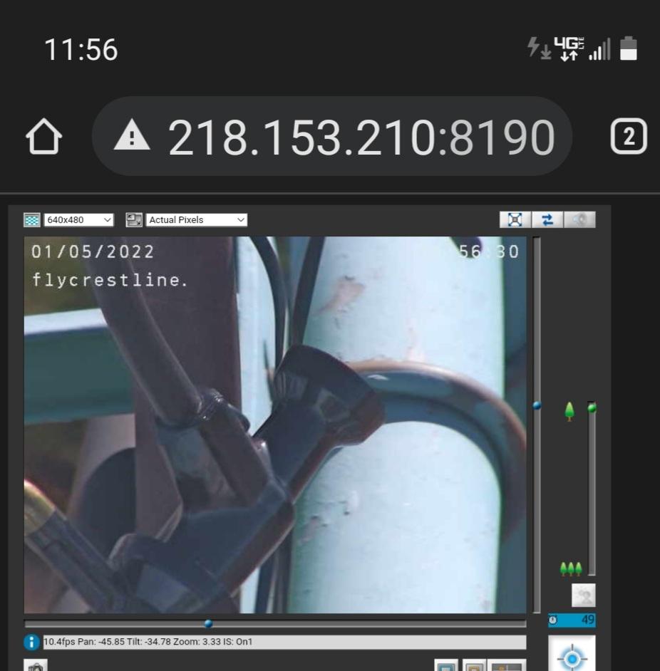
Looks like the cups have broken off.
 Ken Howells General Member
Nuts!
Hopefully it’s just a broken boom.
 Ken Howells General Member
I was going up to the 750 with my Tacoma on the 21st. Numerous fresh rocks down, one area of slumped dirt/ rock. In the long stretch into the canyon there was a big fall of softball-sized rocks from the left with dirt on the right (downhill) missing and concrete re-in beams exposed. The rock pile had been flattened a bit and driven over. I decided a little hop off the 750 wasn’t worth the risk of a flat tire, so I backed up and turned around. Gene came driving down on his utility buggy, having been to Regionals with a load of pilots.
 Ken Howells General Member
Yes! So nice seeing the Crestline weather graphed again! Thanks for everyone’s efforts!
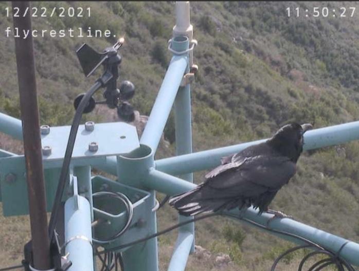
The crows approve too.
Is there a specific link for Holfuy?
 Ken Howells General Member
Yeah! I climbed from the 750 at 2:15 to 4,300 MSL north of Marshall Peak in one long chain of circles with my F3T HG. Heading for Cloud Peak, I saw a PG there get lifted and pushed N quickly with some surges and a tiny tip flutter. They prudently exited west and I decided to give it a go with the firmer HG.
I found this tight 500+ fpm up core that was going N at what felt like 20° above horizontal. It tried to dump me out for several turns as I got farther downwind of the ridge than I wanted to be with so little altitude above it. Headed S to Cloud again, in sink, and found the core again. It had gotten wider but still had that mini-jet-stream feeling. Stuck with it and climbed as it drifted NE and I relaxed and climbed at 300-800 fpm for a while.
At around 5k it slowed to 200 fpm and less and I kept having to find the core again. I debated, as I gained <50′ per circle, what the reasonable altitude for making the jump back to Crestline would be in such conditions. I decided 5,600 would be good with the Falcon from over the middle of the valley. As I approached 5,500 the thermal got stronger and more defined and I circled, almost laughing, to 6,400 right above where the road to Marshall meets the highway.
At Billboard I found a similar fast, low-angle core to 6,500, less dramatically. Other HG’s doing well in the vicinity. Pine was in a concerning lull when I got there but lift did come along to make heading out to Regionals a relaxing glide.
I’d been in the air an hour and was satisfied. Wanted to land with time to hike to the 750 and be back in the lz in daylight, so I landed at 3:25. The Santa Anas had removed most of the wind indicators around the LZ, but I saw a ground-handling PG get dragged a bit, so I knew I’d have an easy SW landing. Also saw Rebar Dan fly his Lightspeed from the Westfall training hill while I was planning my approach. He did several turns and landed way past the HG cone, at the edge of the (vacant) ground-handling area! Good cycle. He flew again after I landed and was just short of the HG cone, which I’d expect most of the time.
Many content pilots in the LZ. Owen said he had flown east to Keller Peak and then west toward Cajon “without turning”! Saw JD well above the 750 as I neared it from below and the sun was diving for the horizon.
What a treat for late November!
 Ken Howells General Member
Something changed on October 1 with the Crestline website ‘Security Certificate’ such that it stopped accepting connections from Python scripts on the Raspberry Pi 3 (crspi). Crspi also uploads the weather info to my personal website, which is where Flymarshall.com gets the data, and that has been working all along. I emailed with former webmaster David Webb for hints on what to change and went up to the weather station several days in a row to try things; even installed a newer (but not the latest] version of the Pi OS. No luck, lots of frustration. Perhaps a brand new Raspberry Pi 4 kit would do the trick.
For the last few days the Crestline anemo hasn’t been reading for some reason but temperature has. That’s why the Flymarshall graph has been blank. The first two numbers after the date should be average wind speed and peak gust, then comes direction and temperature. The zero values after the temperature are normal/unused.
12:35,10/30/2021,0.0,0.0,360,64.7,00, 0.0,0.0,0.00,0.00
12:36,10/30/2021,0.0,0.0,360,64.3,00, 0.0,0.0,0.00,0.00
12:37,10/30/2021,0.0,0.0,360,64.8,00, 0.0,0.0,0.00,0.00
12:38,10/30/2021,0.0,0.0,360,64.6,00, 0.0,0.0,0.00,0.00
12:39,10/30/2021,0.0,0.0,360,64.9,00, 0.0,0.0,0.00,0.00
12:40,10/30/2021,0.0,0.0,360,64.9,00, 0.0,0.0,0.00,0.00
12:41,10/30/2021,0.0,0.0,360,64.4,00, 0.0,0.0,0.00,0.00
12:42,10/30/2021,0.0,0.0,360,64.1,00, 0.0,0.0,0.00,0.00
12:43,10/30/2021,0.0,0.0,360,64.8,00, 0.0,0.0,0.00,0.00
12:44,10/30/2021,0.0,0.0,360,64.4,00, 0.0,0.0,0.00,0.00 Ken Howells General Member
Awesome flight, Owen! You sure went a long way east without turning. The return leg over Highway 18 along Arctic Circle with nothing but mountains in every direction must have been wild. To top it all off, you landed damn close to the cone in that unusual NW wind that started around 3:30!
I launched Marshall at 1:30 and got to 6,300 then was down to 4,900 as I approached Crestline! Got to 8,300 S of Billboard, just circling idly from 6k on. Tee shirt, no gloves, so I bailed from the lift at 8,300. Flew to near Glen Helen then back to Marshall area for a series of ups and downs. Long glides in sink then 1,200 FPM up, spiralling on a wingtip.
Was ready to land about 3:10 but saw absolute zero wind at the LZ. Went to Regionals to kill some time, got some unusual turbulence, back to LZ. Still the same, left again. More turb, including getting shoved sideways SW of Cloud Peak and seeing a huge dust cloud near the 750 with no vehicle in sight.
Saw the flags show an east wind for a bit then a few minutes later all indicated steady NW. I spiralled down and landed from the ESE on the grass north of the cones at 3:30 (a little before Owen came in.)
Numerous pilots came in to land from the East side of the LZ and after bringing their gliders up from the brush told tales of altitude bests and turbulence.
 Ken Howells General Member
All California National Forests closed for at least the next two weeks. Like last year.
All of our CSS launches are on USFS land.
https://amp.fresnobee.com/news/california/article253864053.html
 Ken Howells General Member
Here’s a photo of Eva working on the last harness at the Wills Wing shop on Aug. 18, 2021. Eva worked at WW for 32 years.
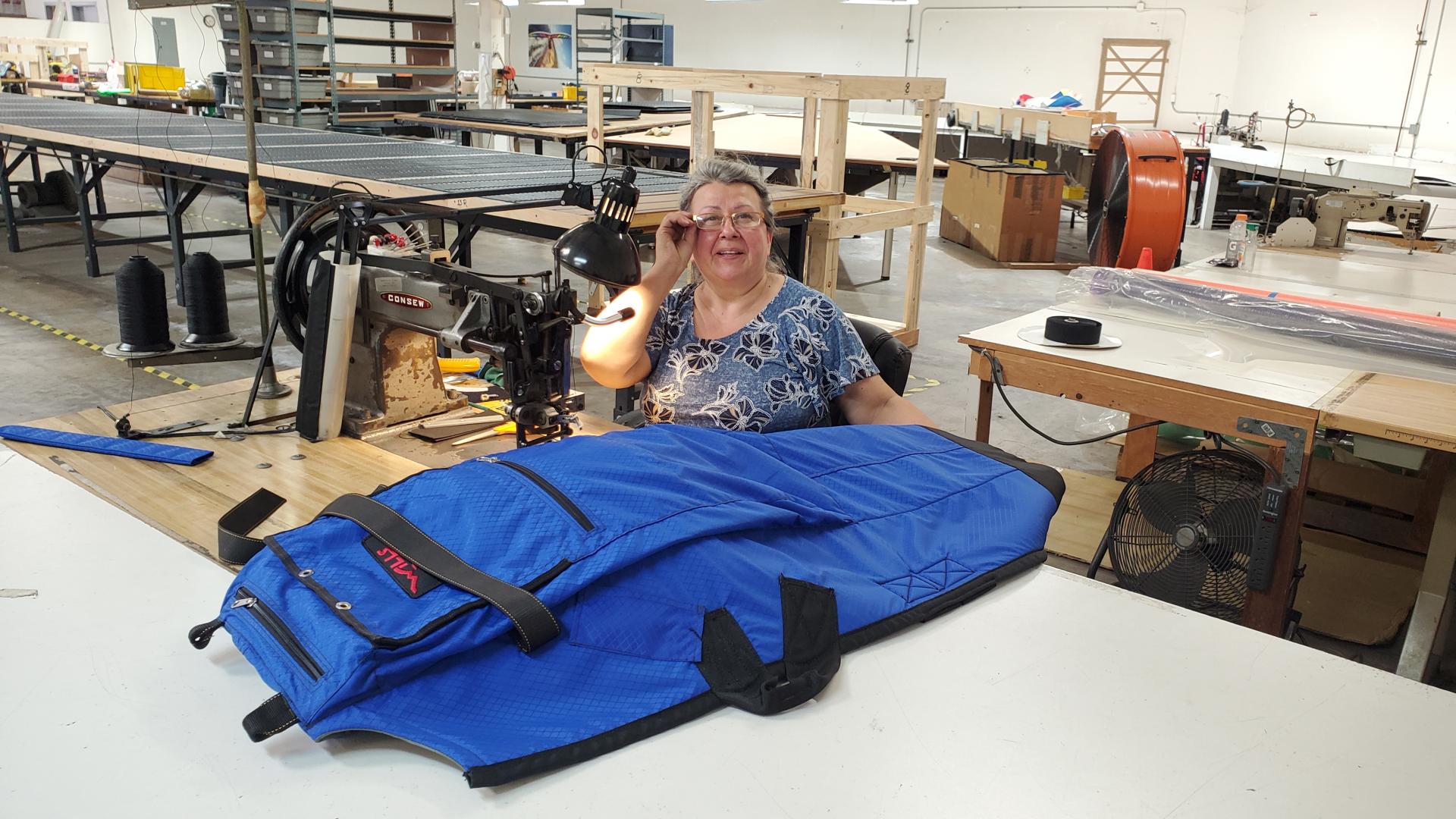
Shipping crates and emptied shelves in the background. Eva was the last shop floor employee still doing their regular job. Except for Eddie, the harried shipper!
 Ken Howells General Member
Thanks for identifying it, Mario.
I thought it was a bit smaller than your usual Red Tail Hawk.
 Ken Howells General Member
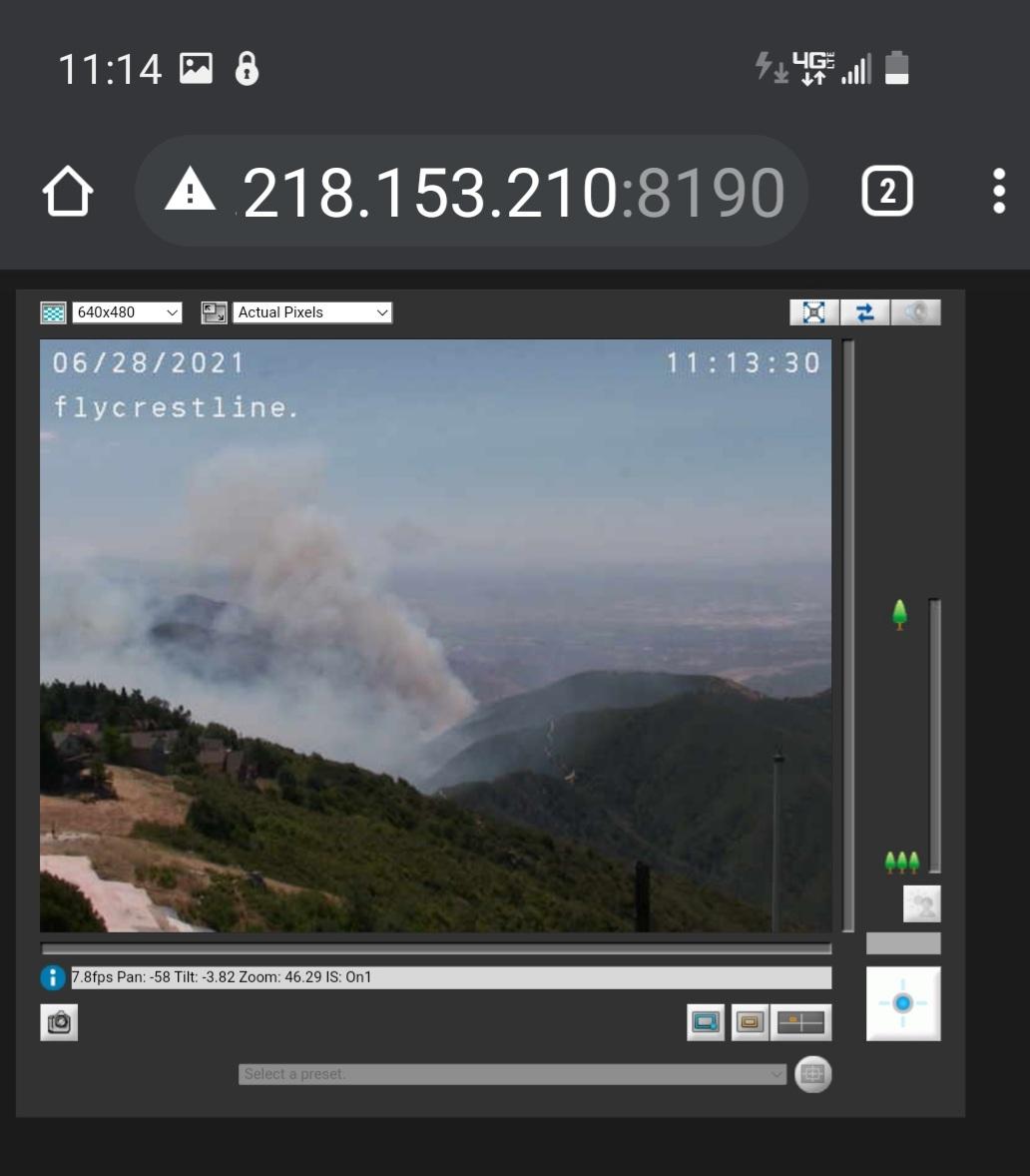
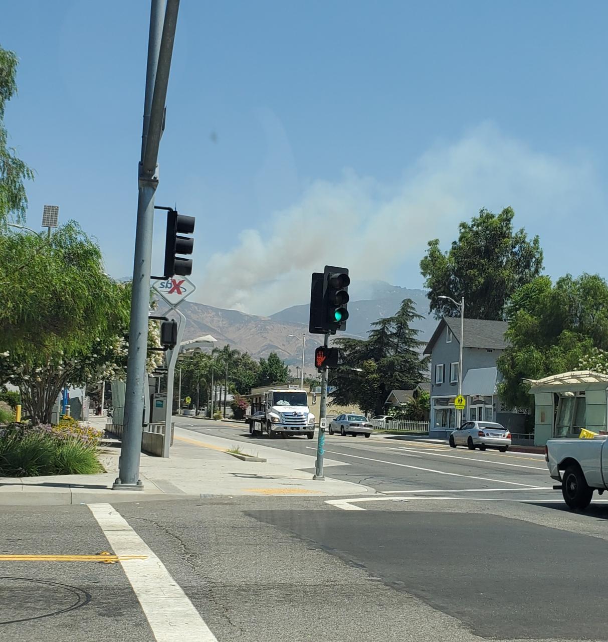
I saw the smoke from my back yard when I was about to get in my truck. Didn’t hear any aircraft at that time. Saw it in the Crestline cam and took a phone pic from Marshall & E Street.
 Ken Howells General Member
Video of the flight.
 Ken Howells General Member
Congrats, David!
 Ken Howells General Member
I’m glad they ran into YOU!
 Ken Howells General Member
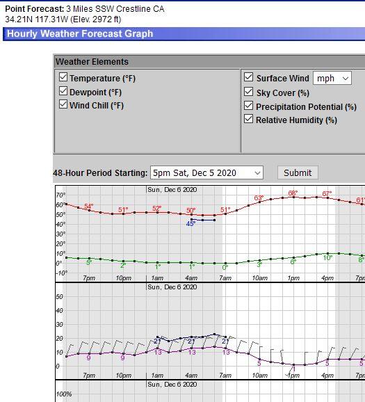
That launchable window on Sunday is closing fast!
Today was great in many dimensions.
-
AuthorPosts