Forum Replies Created
-
AuthorPosts
-
Alan Crouse
Premium MemberIs option 1 a “Fully installed” version of options 5 and 6?
Thank you,
Alan
Alan Crouse
Premium MemberJerome re-packed my Quantum 330: https://www.expandingknowledge.com/Jerome/PG/School/Main.htm
Alan Crouse
Premium MemberRe: insurance, Gary is correct. The policy is available online to all USHPA members and refers to both the flight proficiency rating and special skill endorsements of the pilot. Also could be under the supervision of an instructor.
Alan Crouse
Premium Member“The scales seem to be messed up on BLtop and BLdepth too.” The problem turned out to be that some of the scales were pre-set to specific values. I’ve changed them to scale according to the output values. If some of them look better the other way, please let me know. Easy to switch now that the reason has been identified.
Alan Crouse
Premium MemberToday I think we just about figured out the issue with the SRTM data. Waiting on confirmation from the Netherlands.
Also, the Meteograms are now available from the Windgram site. Radio button to switch between the two formats.
Alan Crouse
Premium MemberI see what you mean. The actual point values seem correct (available from right click), but the scale tops out way too early and a lot of area is at the top color. Probably a holdover from the work done in Europe. The data is converted, but the scaling itself needs to change. Having a top of 3000 is ok when it is meters, but not when it’s feet…
Alan Crouse
Premium MemberI made some changes yesterday that are reflected in today’s Windgrams. We now have data well below Kagel’s peak. It required some modification of the underlying model and removal of the SRTM elevation data, so a non-trivial issue. Still in communication with the gurus in the Netherlands to try and get the SRTM data working.
Alan Crouse
Premium MemberVrezh:
Glad to hear from you. I see exactly what you mean. I’ve reached out to the network of experts to see what options exist…
Thank you,
Alan
Alan Crouse
Premium MemberToday’s (and +1, +2 day’s) Windgrams and RASP data came from the new model. First complete unattended run was last night. Little more fiddling to do, including modifying the Windgram interface to make the Meteograms visible. Both Windgrams and Meteograms are generated now by the standard runs.
In other news, the Soaring Predictor charts have been running off weatherapi.com data for the past few weeks. Looks like NWS has shut down the XML data source that has driven the charts for over a decade. They have a new option, but it will take some significant coding to convert. Three day outlooks in the interim.
Any feedback on the addition of wind-gust to the site detail pages?
– Alan
Alan Crouse
Premium MemberI’ve modified the (not yet in full production) Docker image to produce both the old Windgram format and the new Meteogram format. I’m thinking I could add a button on the windgram web page to let folks choose. Running both models isn’t really a long term option, but I’m becoming increasingly comfortable with the new model results.
The new model is currently running the late day Entire area+1 model (shows up in the RASP viewer around 8 each evening for XC planning). Everything else you see is still the older product.
Alan Crouse
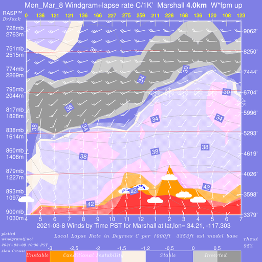
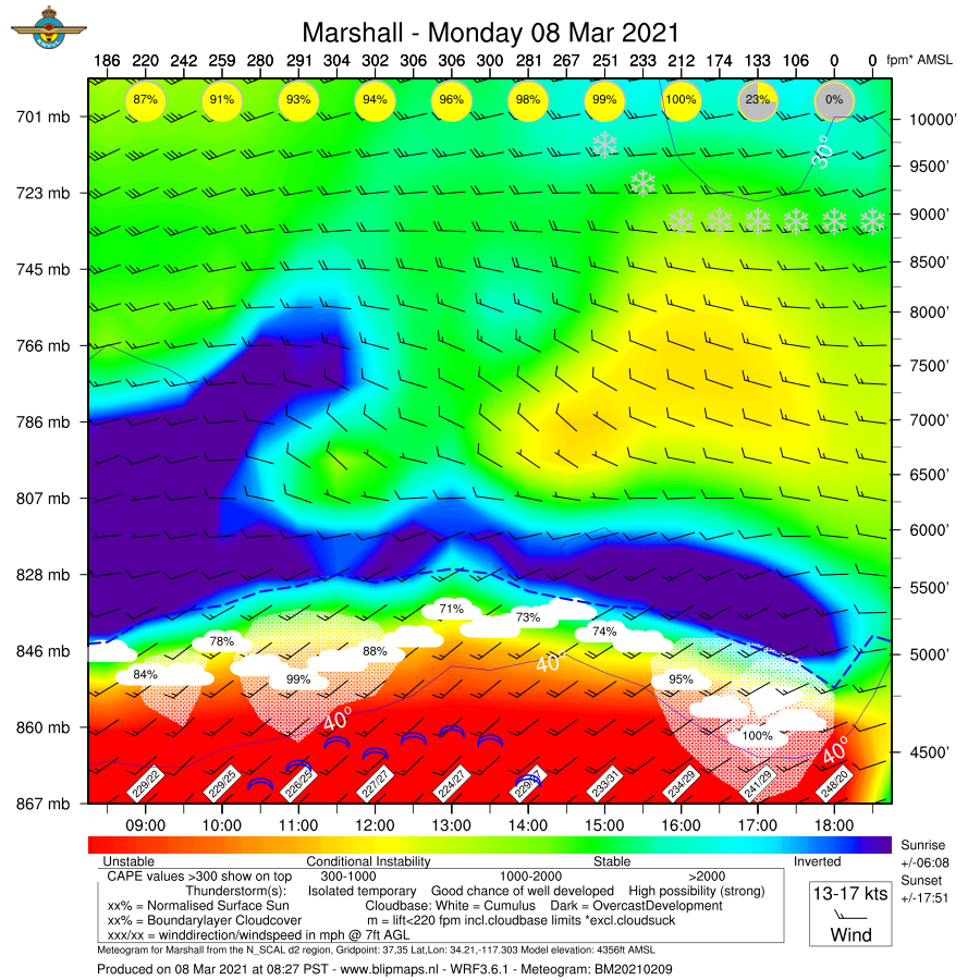
Premium MemberHere’s today (3/8) old model, old format and new model, new format. Mostly to show the new format’s handling of clouds and cloud cover %.
Old model, old format:
New model, new format:
Alan Crouse
Premium MemberHere’s an actual deployment from Aug 2020:
https://crestlinesoaring.org/wp-content/uploads/hm_bbpui/10103/wrq35v9z65qt3oy60lbaq6xdu64uzt01.jpg
Alan Crouse
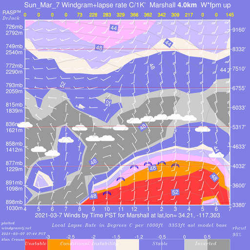
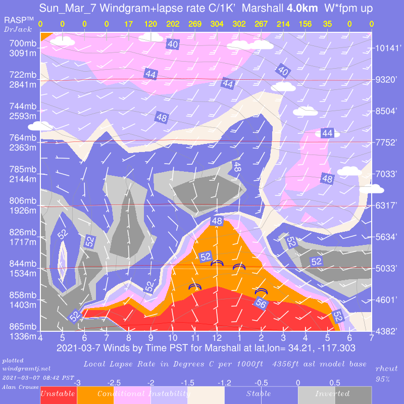
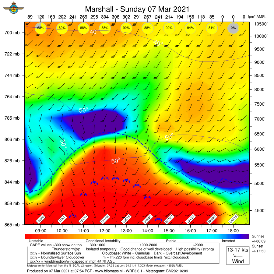
Premium MemberSame deal today (3/7):
– Old model, old format
– New model, old format
– New model, new format
I noticed there were some elements missing from yesterday’s new format version. Fixed that today. Same pattern as yesterday, not a lot of difference, but the new model predicts warmer temps and higher altitudes.
Old model, old format:
New model, old format:
New model, new format:
Alan Crouse
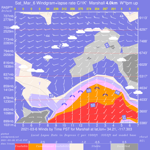
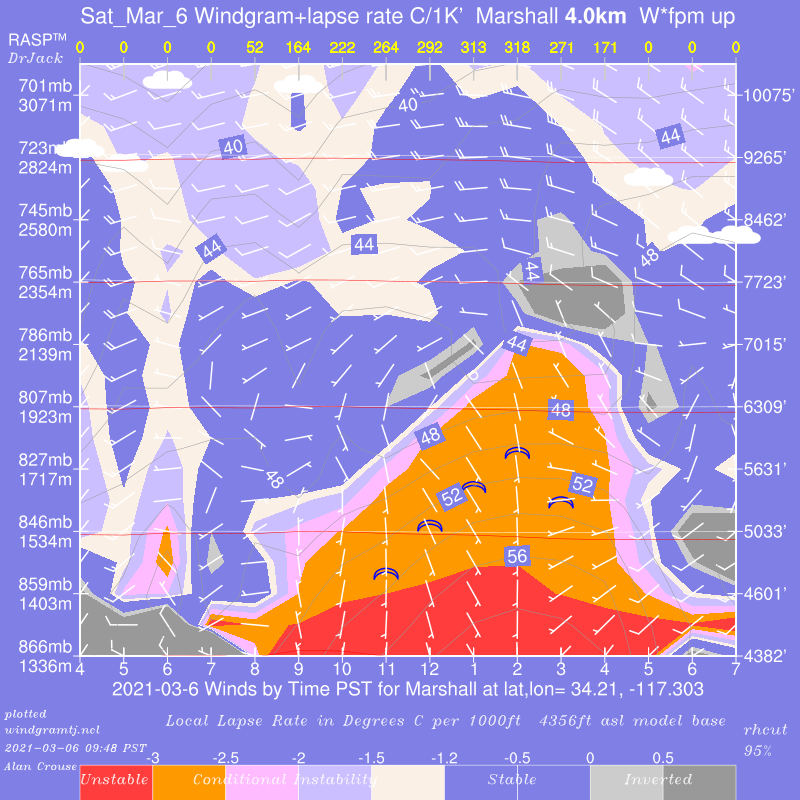
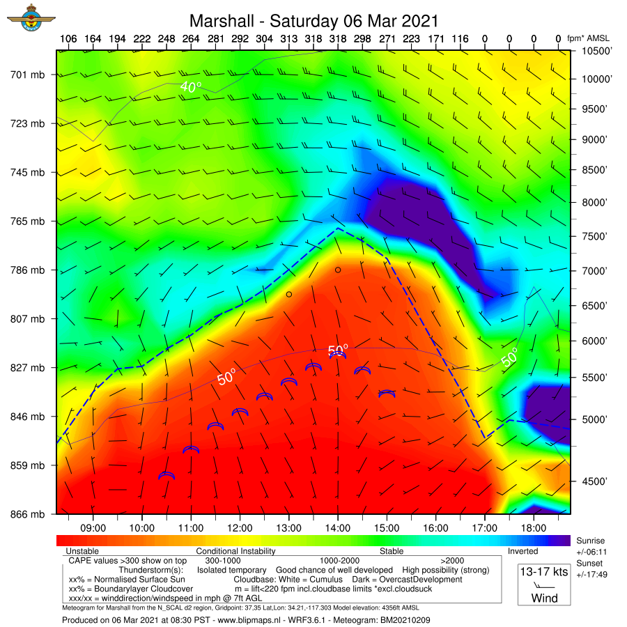
Premium MemberToday (3/6) for comparison we have:
– Old model data presented in old windgram format
– New model data presented in old windgram format
– New model data presented in new windgram (meteogram) format
All are from the same source data. I see only slight differences in the model predictions though the new model is (once again) more optimistic regarding altitudes…
Old Model, Old Format
New Model, Old Format
New model, new format
Alan Crouse
Premium MemberI’ve been back in the passenger area on several late-day flights from OAK to ONT that seemed to fly a diagonal route down the Cajon Pass. We were looking up at the ridgeline… That approach seemed to happen more frequently on north wind days, which always struck me as odd…
-
AuthorPosts