Forum Replies Created
-
AuthorPosts
-
 Jonathan Dietch General Member
Good information! I too have been rotor waked while hang gliding but did not have a severe issue due to my altitude. Let’s not forget what happened to Kevin Williams when he flew into the tip vortex of a fully-loaded fire bomber.
Pro Tip: If an aircraft flies upwind and you begin to smell kerosene turn away immediately.Jonathan Dietch General MemberThursday….
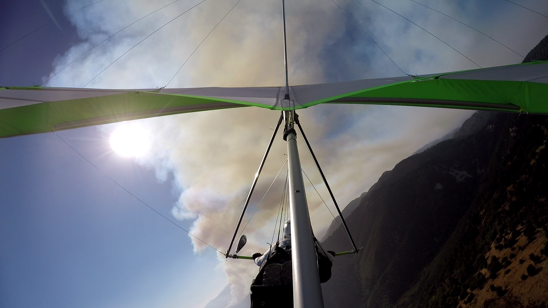 August 17, 2021 at 9:23 AM in reply to: Accident report – paraglider tree landing and helicopter rescue, Marshall #13643Jonathan Dietch General Member
Good news! On the very next day, the pilot and a good friend retrieved the PG and harness intact and they resuming flying. I am friends with this pilot and will assist with mentoring in X/C skills. They are receptive to positive mentoring.
Here’s a positive mentoring tip: Anytime the LZ is out of gliding range, we are in X/C mode and need to find lift or locate another place to land safely. X/C is any flying that places us beyond easy reach of our regular LZ and is not limited ‘long’ distance flying. Plenty of pilots land out while flying locally. It’s a fact of life and one that does not need to become a drama. Let’s keep it upbeat people.
Jonathan Dietch General MemberI agree with all of Tim’s sentiments but must caution that the upper launch is always sketchy for hang gliders unless you go off the very top of the West side when the wind is SW. That portion is steep and it’s easy to see whether or not the wind is filled in by the swaying of the wild grass. We had a blown launch from just below there a few weeks ago by a pilot on a topless who was negligent and unfamiliar with the nuances of top-launching. I must further caution that another pilot on a topless was nearly killed after top-launching in thermic conditions. In general it’s just safer to walk down to either ramp and get into the airflow along a steep drop-off.
Jonathan Dietch General MemberHi Doug,
You spotted a pair of Santa Barbara pilots–Neal & Michael who launched from Blackhawk and were headed West. There was also one HG–Willy from SB as well.
Can I hit you up for a high desert drive and chase some time?
Cheers,
Jonathan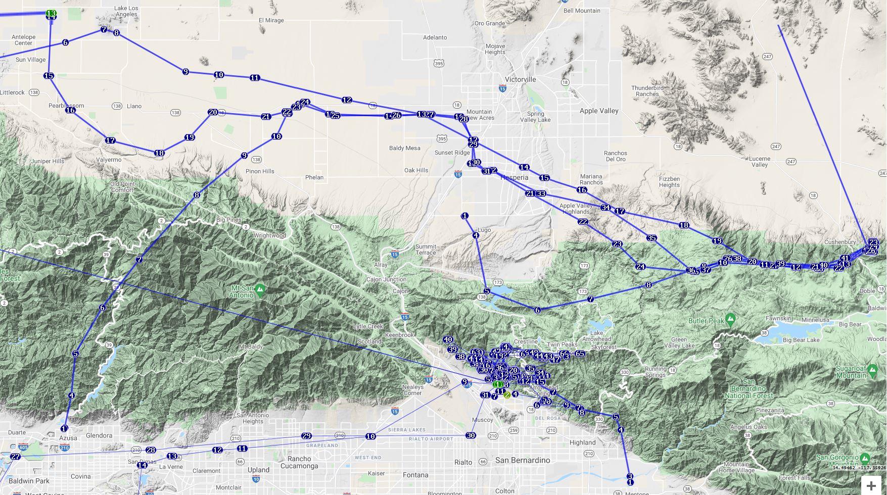 Jonathan Dietch General Member
“It wasn’t me.” Bart Simpson
May 17, 2021 at 5:20 PM in reply to: Incident report – Hangglider unplanned landing Regionals #12498Jonathan Dietch General MemberSuggested Corrective Action: Pedal faster, dammit!
Jonathan Dietch General MemberBummer!!!! Sorry to see you go.
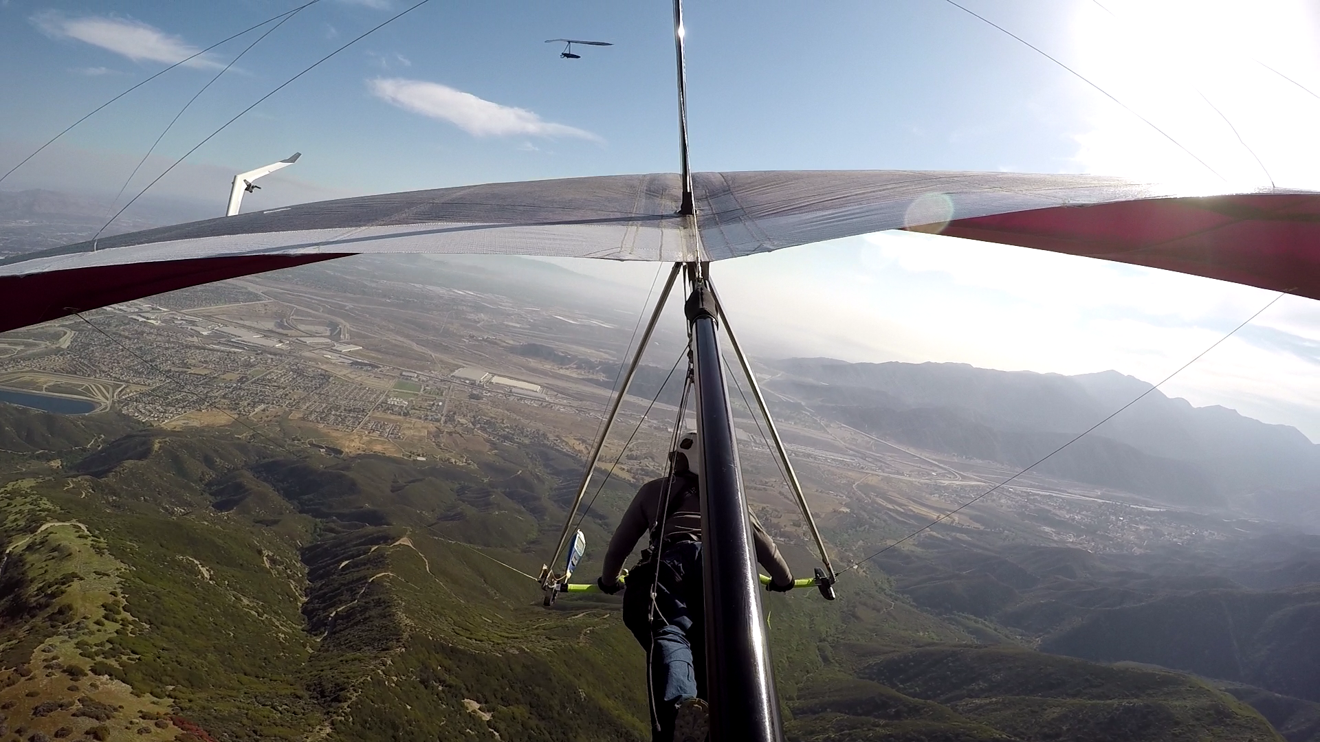
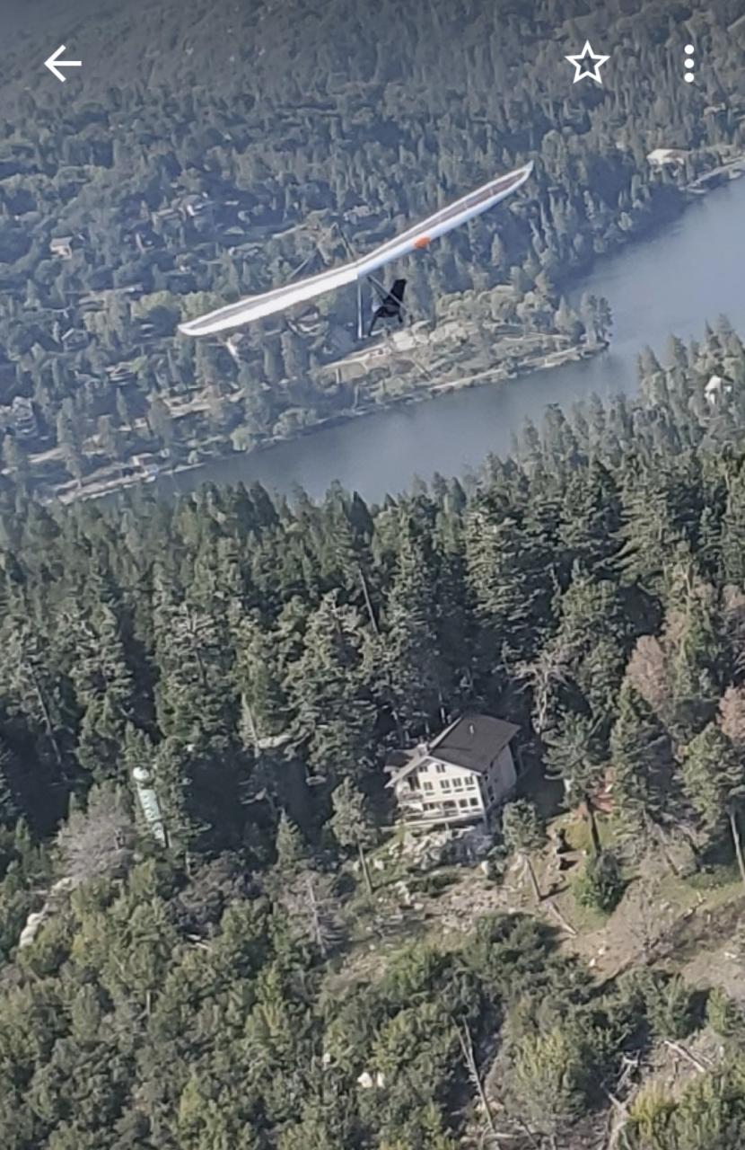
Jonathan Dietch General MemberGreat photo Ken! I wasn’t planning on flying today after yesterday’s adventure to the brewery but changed my mind after I looked at the forecast in the morning. Andy & I were going to go it alone until some spaces opened up last moment on the 130 SandyV. I launched around 255ish and flew to Crest Park 6.3 miles in 11-1/2 minutes without turning on my S3-155. From there it was a lot of work and turbulence until well after 5PM. In spite of exhaustion I landed correctly around 6:25 after a lot of fun and interactions with all kinds of birds, HGs and a few motorized Swifts.
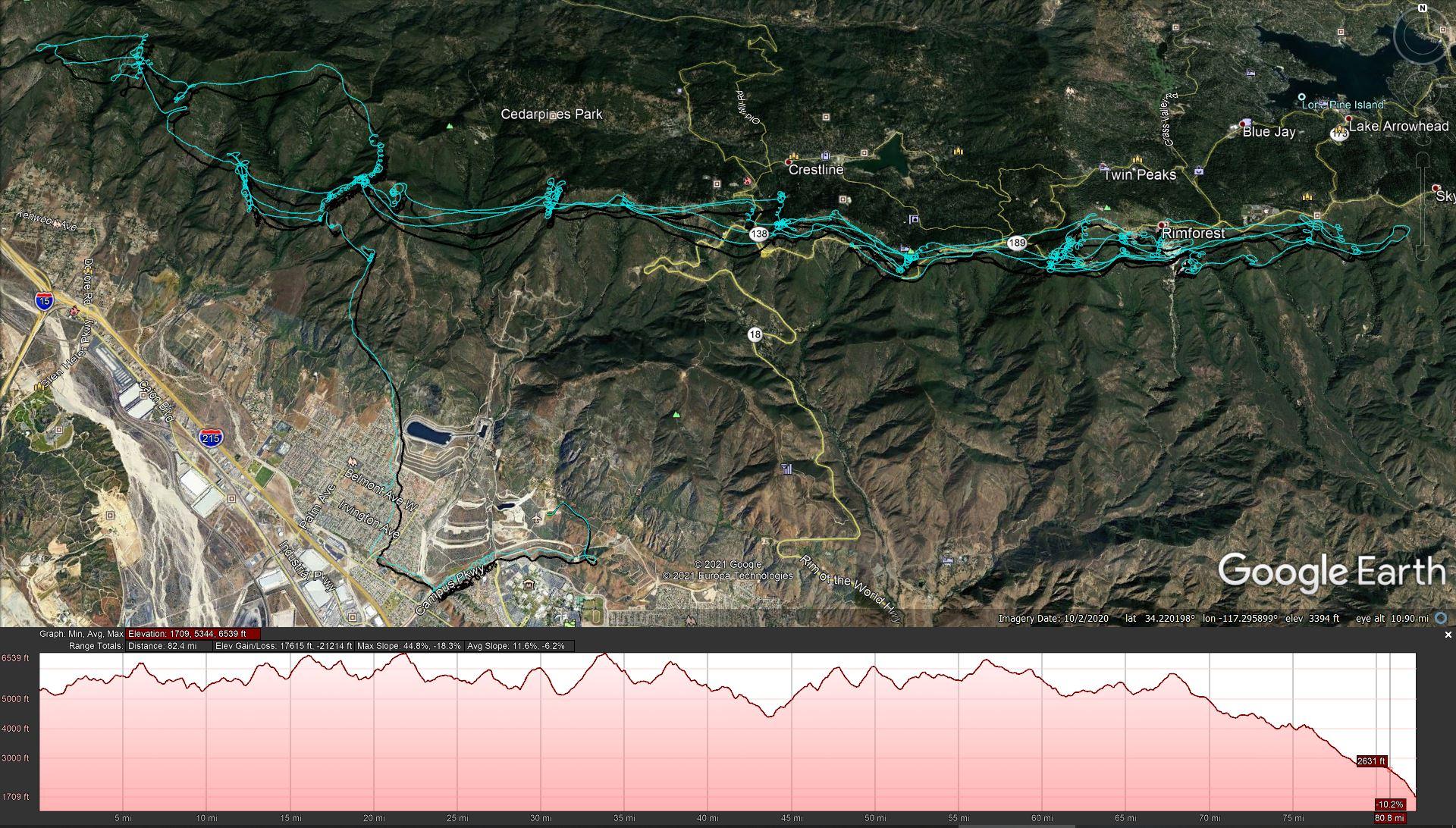
From Bruce’s Swift….
 Jonathan Dietch General Member
Thanks for all the maintenance you do along with the others. Without our information infrastructure I would not have known to change my Sunday plans and get on the 2PM Atmosphere van.
Short edit: https://www.youtube.com/watch?v=RUtJk6eE6U4
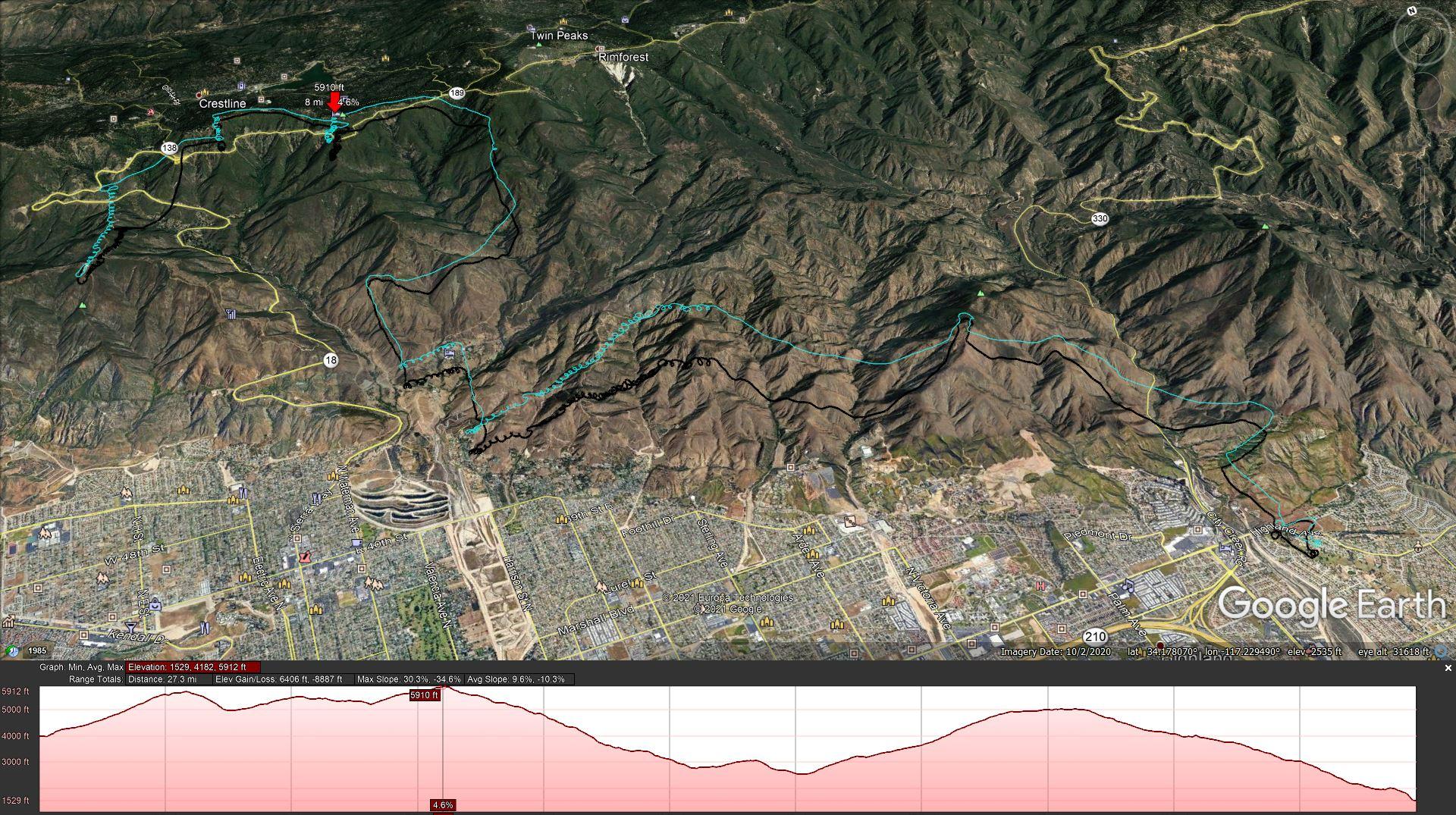
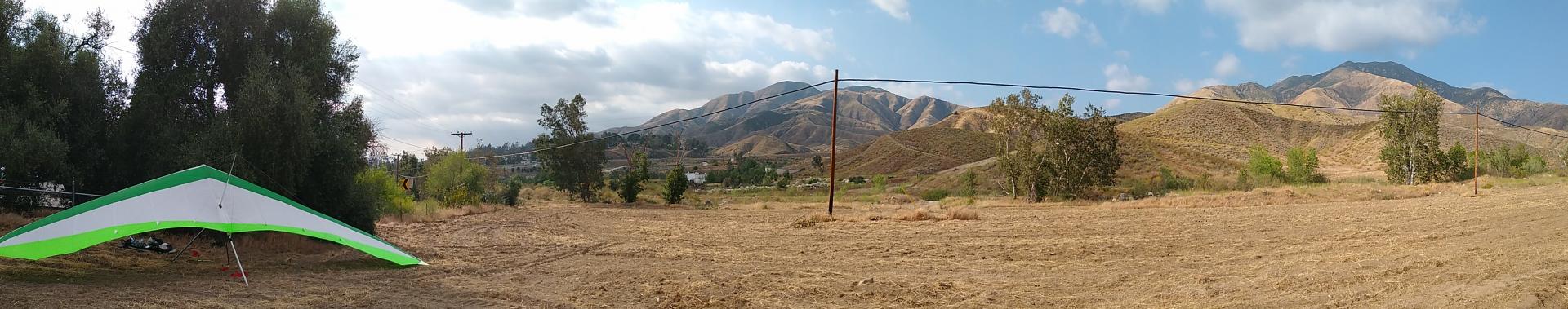
I got set up and launched at 3:35PM from the top of Marshall at the West corner. I was flying my single surface floater HG. I climbed to 5600′ as I drifted back and avoided cloud suck on the way. I headed for the cloverleaf arriving at 5K and worked my way back up eventually topping above 58 at RnR. I may have been wiser to head out over the valley floor along the cloud bottoms but chose to cross the blue hole to Bayliss Park. I got there too low to connect and hit the cloud deck to the East. I soon found myself setting up to land in the park off of Old Waterman Cyn Rd and 18. I got a brief low save there and headed for the spine East of the resort. I connected there and climbed from 2500 to 5K as I drifted toward McKinley. McKinley wasn’t working and I jumped to Harrison which also wasn’t working. I worked the ridgeline with the homes on it South of Highland Ave and East of 330. I will remember this for the future because the ridge and the plowed field behind it are major thermal sources. I landed inside of a ground level thermal which carried me and extra 100′ or so. I plunked down getting my bar and pod dirty but it was fun playing in the ground thermal. Unable to get a ride or driver quickly I finally caught an Uber back. I gave the driver a good tip since he went through a lot of dust from the off-road people. Drove back to the field behind the American Legion hall and grabbed my wing hidden behind the trees with the GPS tracker inside and running.
 Jonathan Dietch General Member
So you opened the tie-down cover and the coiled rope sprang to life?
Will it also stop the dogs from marking their territory on your sail in time? Jonathan Dietch General Member
There’s an online communication form for the next time this happens and it probably will given the difficulties for multitudes who live in SoCal: https://www.fs.usda.gov/contactus/sbnf/about-forest/contactus
Jonathan Dietch General MemberAn out of state HG truck was pulling in this afternoon as I was pulling out. Perhaps these are the same group? IDK.
Jonathan Dietch General MemberJonathan Dietch General MemberHere’s the flight…
-
AuthorPosts